
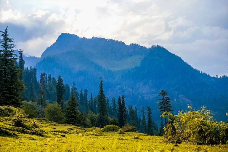
Gomukh Tapovan Trek Package Walk from the sacred town of Gangotri to Gomukh, the snout of the Gangotri Glacier, and continue towards the high-altitude meadows of Tapovan beneath the dramatic peaks of Shivling and the Bhagirathi group. Our Gomukh Tapovan Trek Package is designed for trekkers who want more than a short pilgrimage walk. The route combines high-altitude trekking, glacier landscapes, mountain camps and the spiritual atmosphere of Gangotri. The trek is physically demanding, especially beyond Gomukh towards Tapovan, so the itinerary is planned around realistic walking hours, acclimatization, weather conditions and local route requirements. Gomukh Tapovan Trek Package at a Glance Trek Detail Information Trek Name Gomukh Tapovan Trek Package Gomukh Tapovan Trek Package 2026 Starting Point Gangotri, Uttarakhand Trek Route Gangotri – Chirbasa – Bhojbasa – Gomukh – Tapovan – Bhojbasa – Gangotri Duration 6–7 Days, depending on package plan Maximum Altitude Approximately 4,460 m / 14,600 ft at Tapovan Difficulty Moderate to Challenging Trek Type High-altitude Himalayan trek Best Season Generally May–June and September–October, subject to local conditions Accommodation Hotel/guesthouse + camping Starting Price Contact us for the current 2026 group price Guide Local trek guide/support as per package Permit Required for the Gangotri National Park route Starting City Gangotri Tapovan is generally described at around 4,460 m, while Gomukh is around 3,900–4,000 m depending on the source and measurement point. Gomukh Tapovan Trek Package Overview The Gomukh Tapovan Trek begins at Gangotri, one of Uttarakhand’s most important pilgrimage destinations. From Gangotri, the trail follows the Bhagirathi valley through Chirbasa and Bhojbasa before reaching Gomukh. The landscape changes noticeably as you gain altitude. Forest vegetation gradually becomes sparse, the valley opens up around Bhojbasa, and the trail becomes increasingly rocky as you approach Gomukh. Gomukh is the snout of the Gangotri Glacier and an important pilgrimage destination associated with the origin of the Ganga. The Tapovan section is considerably more demanding. From Gomukh, the route involves steep climbing and rough glacial/moraine terrain before reaching the high-altitude meadows of Tapovan. Uttarakhand Tourism describes the Gomukh-to-Tapovan section as a steep and challenging climb and recommends doing it with a guide. From Tapovan, trekkers get close views of major Himalayan peaks including Mount Shivling and the Bhagirathi group. Gomukh Tapovan Trek Itinerary Day 1: Arrival in Gangotri – Acclimatization Altitude: Approximately 3,048 m Trekking: No major trekking Arrive in Gangotri and check into your accommodation. After settling in, take a short acclimatization walk around Gangotri. You can visit the Gangotri Temple and spend some quiet time near the Bhagirathi River. The main purpose of the day is to allow your body to adjust to Gangotri’s high altitude before starting the trek. Overnight: Gangotri Meals: Dinner Day 2: Gangotri to Chirbasa Trek: Approximately 8–10 km Walking time: Around 4–5 hours Difficulty: Moderate After breakfast, begin the trek from Gangotri. The trail follows the Bhagirathi valley and gradually moves away from the town. Chirbasa is one of the important points on the route and marks the transition towards the more open high-altitude landscape. The trail is relatively manageable compared with the Gomukh–Tapovan section, but the starting altitude makes pacing important. Overnight: Chirbasa/Bhojbasa, depending on the final itinerary and permitted camping arrangements Meals: Breakfast, lunch and dinner Day 3: Chirbasa to Bhojbasa Distance: Approximately 5–6 km Walking time: Around 3–4 hours Altitude: Approximately 3,800 m Continue towards Bhojbasa through increasingly open terrain. The Bhagirathi peaks become more prominent as you move deeper into the valley. Bhojbasa is an important halt before Gomukh. This is also a useful day for conserving energy because the next stage towards Gomukh and Tapovan is more demanding. Overnight: Bhojbasa Meals: Breakfast, lunch and dinner Uttarakhand Tourism lists Bhojbasa at approximately 3,800 m and notes that camping beyond Bhojbasa towards Gomukh is prohibited under the stated itinerary guidance, so the exact overnight arrangement should follow current forest regulations. Day 4: Bhojbasa – Gomukh –
Gomukh Tapovan Trek Package Walk from the sacred town of Gangotri to Gomukh, the snout of the Gangotri Glacier, and continue towards the high-altitude meadows of Tapovan beneath the dramatic peaks of Shivling and the Bhagirathi group. Our Gomukh Tapovan Trek Package is designed for trekkers who want more than a short pilgrimage walk. The route combines high-altitude trekking, glacier landscapes, mountain camps and the spiritual atmosphere of Gangotri. The trek is physically demanding, especially beyond Gomukh towards Tapovan, so the itinerary is planned around realistic walking hours, acclimatization, weather conditions and local route requirements. Gomukh Tapovan Trek Package at a Glance Trek Detail Information Trek Name Gomukh Tapovan Trek Package Gomukh Tapovan Trek Package 2026 Starting Point Gangotri, Uttarakhand Trek Route Gangotri – Chirbasa – Bhojbasa – Gomukh – Tapovan – Bhojbasa – Gangotri Duration 6–7 Days, depending on package plan Maximum Altitude Approximately 4,460 m / 14,600 ft at Tapovan Difficulty Moderate to Challenging Trek Type High-altitude Himalayan trek Best Season Generally May–June and September–October, subject to local conditions Accommodation Hotel/guesthouse + camping Starting Price Contact us for the current 2026 group price Guide Local trek guide/support as per package Permit Required for the Gangotri National Park route Starting City Gangotri Tapovan is generally described at around 4,460 m, while Gomukh is around 3,900–4,000 m depending on the source and measurement point. Gomukh Tapovan Trek Package Overview The Gomukh Tapovan Trek begins at Gangotri, one of Uttarakhand’s most important pilgrimage destinations. From Gangotri, the trail follows the Bhagirathi valley through Chirbasa and Bhojbasa before reaching Gomukh. The landscape changes noticeably as you gain altitude. Forest vegetation gradually becomes sparse, the valley opens up around Bhojbasa, and the trail becomes increasingly rocky as you approach Gomukh. Gomukh is the snout of the Gangotri Glacier and an important pilgrimage destination associated with the origin of the Ganga. The Tapovan section is considerably more demanding. From Gomukh, the route involves steep climbing and rough glacial/moraine terrain before reaching the high-altitude meadows of Tapovan. Uttarakhand Tourism describes the Gomukh-to-Tapovan section as a steep and challenging climb and recommends doing it with a guide. From Tapovan, trekkers get close views of major Himalayan peaks including Mount Shivling and the Bhagirathi group. Gomukh Tapovan Trek Itinerary Day 1: Arrival in Gangotri – Acclimatization Altitude: Approximately 3,048 m Trekking: No major trekking Arrive in Gangotri and check into your accommodation. After settling in, take a short acclimatization walk around Gangotri. You can visit the Gangotri Temple and spend some quiet time near the Bhagirathi River. The main purpose of the day is to allow your body to adjust to Gangotri’s high altitude before starting the trek. Overnight: Gangotri Meals: Dinner Day 2: Gangotri to Chirbasa Trek: Approximately 8–10 km Walking time: Around 4–5 hours Difficulty: Moderate After breakfast, begin the trek from Gangotri. The trail follows the Bhagirathi valley and gradually moves away from the town. Chirbasa is one of the important points on the route and marks the transition towards the more open high-altitude landscape. The trail is relatively manageable compared with the Gomukh–Tapovan section, but the starting altitude makes pacing important. Overnight: Chirbasa/Bhojbasa, depending on the final itinerary and permitted camping arrangements Meals: Breakfast, lunch and dinner Day 3: Chirbasa to Bhojbasa Distance: Approximately 5–6 km Walking time: Around 3–4 hours Altitude: Approximately 3,800 m Continue towards Bhojbasa through increasingly open terrain. The Bhagirathi peaks become more prominent as you move deeper into the valley. Bhojbasa is an important halt before Gomukh. This is also a useful day for conserving energy because the next stage towards Gomukh and Tapovan is more demanding. Overnight: Bhojbasa Meals: Breakfast, lunch and dinner Uttarakhand Tourism lists Bhojbasa at approximately 3,800 m and notes that camping beyond Bhojbasa towards Gomukh is prohibited under the stated itinerary guidance, so the exact overnight arrangement should follow current forest regulations. Day 4: Bhojbasa – Gomukh –